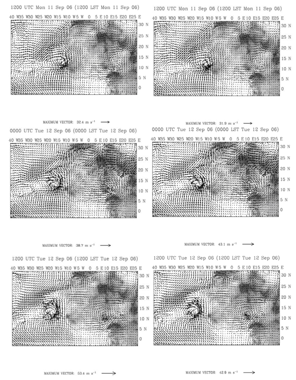
Fig. (5)
Wind vector simulation at 900 hPa from Sep 11 1200UTC to Sep 12 1200UTC every 12 hours, left panel correspond to CTRL experiment and right panel correspond to the COSMIC-All experiment. Gray scale corresponds to topography (elevation).