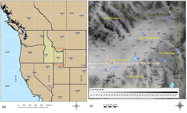
Fig. (1)
East Idaho: (a) Map of the west United States (filled brown colors; Idaho: filled yellow color), contiguous Pacific Ocean (solid light blue color), four-letter station identifiers (NOAA-NWS) (dark blue triangle symbols with dark blue labels), and meridians and parallels (dashed white lines with black labels: degrees); (b) United States Geological Survey (USGS) Digital Elevation Model (DEM) (m MSL) terrain (90-m: grey shades), water bodies (filled light blue regions), geographic regions (italic yellow labels), city names (filled green circles with black labels), station identifiers (airport, tower, and triangle symbols with black labels), and WSR-88D location (purple dish symbol with black label, KSFX). The Birch Creek (A), Little Lost River (B), and Big Lost River (C) Valleys (purple labels) are the tributary valleys in the Central Mountains. The transects (X1, X2, X3, X4: dashed colored lines) are described in the text.