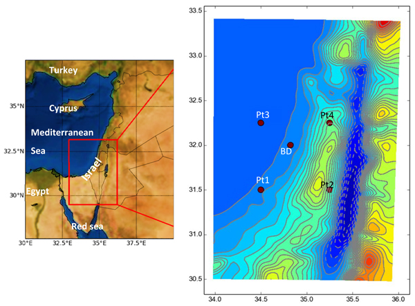
Fig. (1)
The EM region and the study area showing Beit Dagan (BD) (~ 30 m ASL) and the 4 closest ERA-Interim grid points. Pt3 over the Mediterranean Sea, Pt1 on the seashore like BD but further south (~63 km), Pt4 and Pt2 are inland points over complex topography. Pt2 is on the eastern slope of the Judea Mountain, Pt4 to the North of Samaria Mountain (~ 600-800 m ASL).