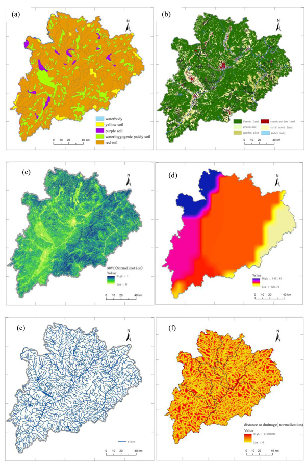
Fig. (4)
Input data layers (
a
) soil types; (
b
) land use type; (
c
) NDVI; (
d
) 24h heaviest rainfall; (
e
) river; (
f
) distance to drainage.