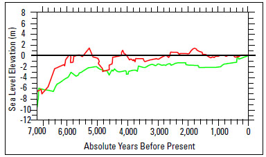
Fig. (8) Sea-level histories for northern Gulf of Mexico for the last 7,000 years developed from calibration samples currently located seaward
of the present shoreline (green curve) and calibration samples that are currently located landward of the present shoreline (red curve).
See text for discussion (modified from Balsillie and Donoghue (2004) [52]).